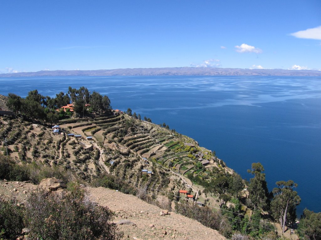
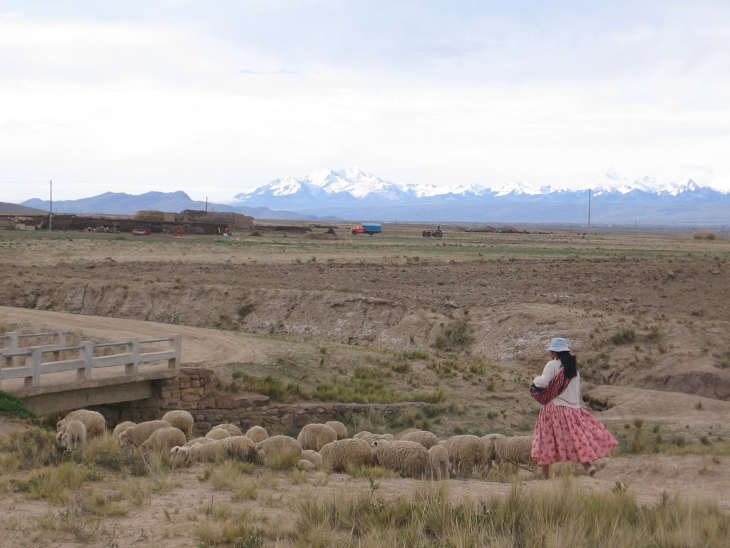
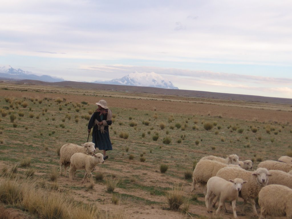
Much of the Isla del Sol in Lake Titicaca is terraced into plots for potatoes, cereal grains and other crops suited to the altitude of 13,000 feet above sea level. The hills that rise up all around the lake show a similar terracing. This area was part of the Tiwanaku empire 2,000 years ago, an empire I had never heard of. At its peak, it reached into Peru, Ecuador, Chile, Venezuela and Argentina. The island was a cultural and religious center for the Tiwanaku and the Incas who followed them.

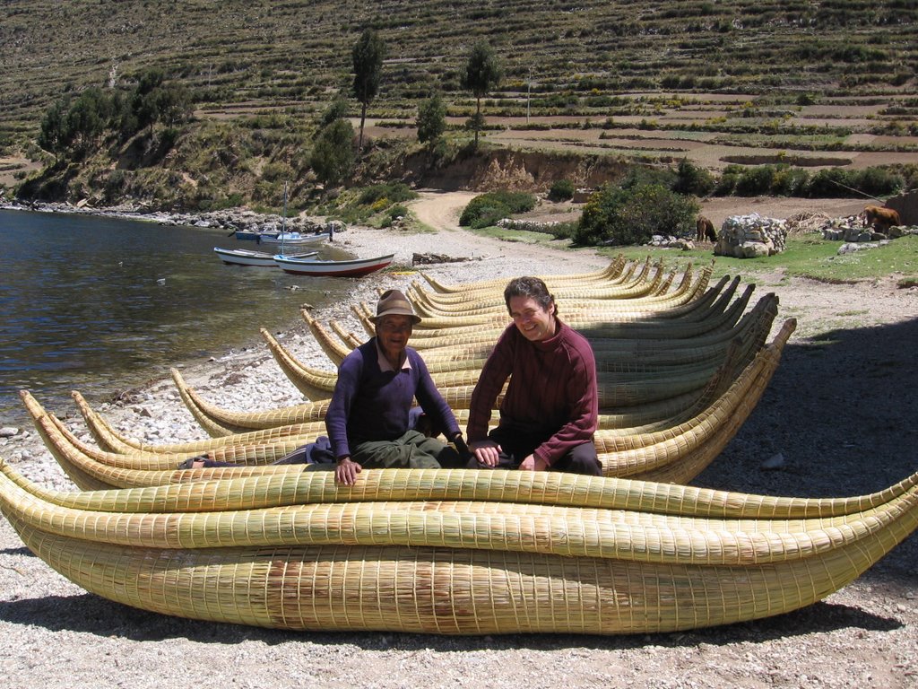
Local Aymara Indians still make boats (which they call balsas) from the totora reed, and these on the beach at Yampupata are specifically for use by tourists, two to a boat with paddles. I didn´t have time to indulge.
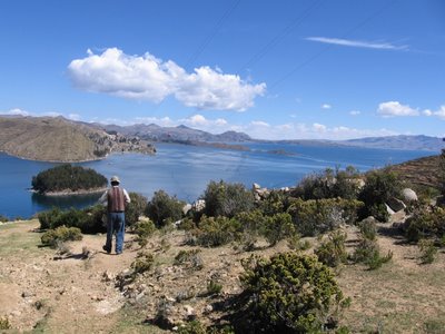
The terrain is very dry all around Lake Titicaca, whose name comes from two Aymara words meaning puma and stone. My guide, Samuel, speaks Aymara as do most people in the La Paz and El Alto area. Here we´re descending from the peaks on the Isla del Sol. I was short of breath after the climb.
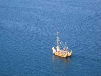
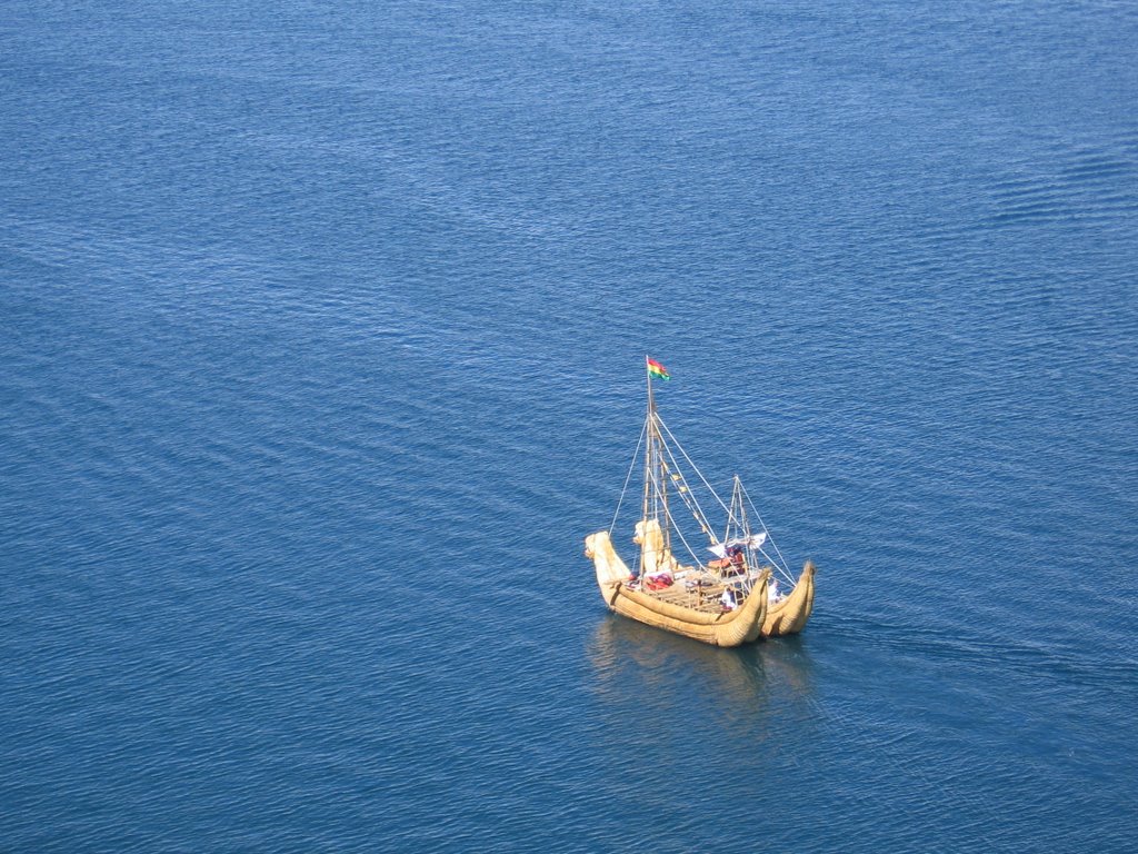
Unfortunately, this double-hulled reed boat pulled out before I could close enough for a good shot. The boat is probably 25 feet long and made completely of totora reeds that grow beside the lake. The prows display stylized puma heads.


Subsistence farming mixes in with tourism on the Isla del Sol, and not always comfortably. Still, a good hotel costs only about $30 night. Food and labor are inexpensive. A great meal of trout, salad and a couple of sides costs about $3.


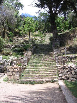
These stone steps up from the beach on the Isla del Sol are supposed to date from Inca times (the 1400s) or earlier.
+++
A diary entry from 2006 about this trip
Samuel was my guide for trip to Tiwanaku, a pre-Incan site west of La Paz, and Copacabana, jumping off point for Lake Titicaca and the Isla del Sol. I found him in a little travel agency behind the church of San Francisco in the tourist area of La Paz. We talked for an hour about where he would take me, various options.
In the end, we agreed to a day and a half trip to the ruins of Tiwanaku, a night in Huatapata on the shore of Lake Titicaca, on to Copacabana and the Isla del Sol, an island with Inca ruins.
Meals, hotel, admission to museums, driver, boat trips, ferry, etc., $158.
OK. I had a driver and private guide. I forgot to ask about the vehicle.
Samuel is 35, speaks Aymara, the language of President Evo Morales, as well as Spanish, and has different ideas about auto safety. The vehicle he picked me up in was a 1984 Jeep Wagoneer, a big thing with terrible shocks and springs, a front end out of alignment, and altogether shaky safety features. The good thing about it was that it is a 4x4 with monster traction, which proved really important on some of the lousy dirt roads we took to some great sites. To be honest, my nightmare scenario was seeing the Wagoneer conk out in the middle of nowhere, but it made it.
We went first to Tiwanaku, a huge site with a pyramid, several temples and lots of sculptures from a culture that preceded the Incas. The Tiwanaku culture, which I had never heard of, sprang up about 1500 BC and at its peak in the early Christian era, it had an empire that reached into what is now Peru, Ecuador, Venezuela and Argentina. Their buildings had many of the astronomical features of the Mayas, that is they were built in a fashion that tracked the important stages of the sun and moon. Some amazing sculptures on the site.
The civilization died out in around 1200 AD, probably because of a Niño effect that resulted in a severe drought that lasted for several decades. Samuel hired a special guide, Macario, to take me around the site. He was also an Aymara speaker. His Spanish was very fast but very clipped and precise. Some of the things he told me about the monuments were preposterous, but one of the marvels he showed me was the real thing. The Tiwanaku had carved a swirled hole through a stone in the temple wall. The swirls were cut to mimic the shape of the inner ear. A priest would put a kind of megaphone into one end of the hole and it created a tremendous amplification effect. Macario demonstrated to the sceptical journalist, who became a believer in this story. The idea was that a priest could speak to 10,000 people in the courtyard of the temple and be heard. I believe it, although I don´t believe that sculptures in one of the temples represent races of China and Africa, as Macario said. They represent different ethnic groups ruled over by the Tiwanaku, scholars believe.
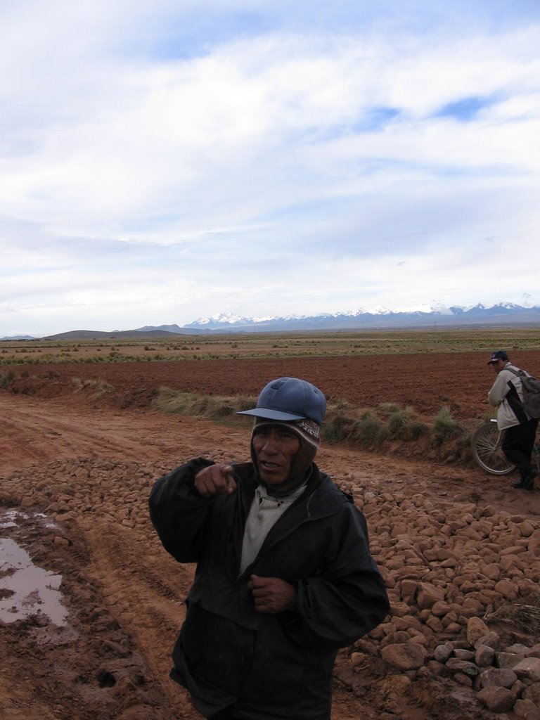
Samuel asked me if I was OK with travelling on a dirt road rather than the highway to our hotel in Huatapata to cut the distance in half. I said sure. It´s all subsistence farms in every direction once you´re outside the city. There are no vehicles and no machinery. I saw people plowing with animals, either bovines or mules, and working with hoes and shovels. They raise sheep, cattle, llamas and pigs, and they grow potatoes and cereal grains. The road was really bad in places, and it wasn´t always clear that we would make it through the mud. At one point we came upon some Aymaras filling up the potholes with rocks. One of the guys was wearing a Chicago White Sox cap. I told him they were the world champions of baseball. He was very amused. Ball caps from US colleges and professional sports teams are everywhere – used clothing pours into this country from the U.S.
Since no one out here owns a vehicle, people walk, ride a bicycle, hitchhike or catch one of the minibuses. It was getting dark, the road was really bad and all I could think of was that if the jeep got stuck in one of the mudholes, we were going to be sleeping in an adobe hut with a straw roof that night.
We made it into Huatapata and had a great dinner of Lake Titicaca trout. The hotel, Hotel Titikaka, is right on the shore. It was very cold in my hotel room, but it was a good place, $30 a night.
The next morning we rose early because we needed to get to Copacabana before the professional bicycle race (a sort of Tour of Bolivia, which lasts a week) closed down the road. As we came around a curve, we saw a minibus lying on its side in the road. The driver evidently went into the curve too fast, went off the road, climbed up the hill on the opposite side and rolled over. As is typical with public transport out in these areas, the bus (really a minivan) was overloaded with about 20 people. One teenage girl had a bloody nose, but otherwise no one was hurt. I helped about a dozen guys turn the thing upright (of course, the counterfeit batteries I had unwittingly bought for my camera failed and I didn´t get a picture). We took two adults and six kids in the backseat to the straits of Tiquina, where we met another fine example of public transport, the motor launches that carry poor folks (all folks) across for 20 cents. The boats are small and they put two dozen people in. The boat I was in listed to starboard about 5 degrees, the water was choppy, a crosswind rocked the boat and a 12-year-old was at the tiller. I was ready to jump. No life preservers aboard, no safety. That´s why you read about these horrible accidents involving ferry boats and buses in poor countries. The people can´t pay much and there is no maintenance or safety.
Copacabana is a corruption of two Aymara words that mean View of the Lake and refers to the high hills on either side of the city. We had missed the morning ferry to Isla del Sol, so we decided to take the dirt track that follows the edge of the hills to Yampupata, which is much closer to the island. Along the way we stopped at the stone city of Samaya, which has homes built around 800 years ago, before the Incas, and which the locals are trying to develop as a tourist attraction. The biggest deterrent is the fact that the road there is pretty scary. The road hugs the side of a hill for almost all of the 8 or 9 km. from Copacabana, and there is a dropoff of a couple hundred feet if the driver makes a mistake or hits a pothole and loses control. Samaya reminds me of the abandoned stone village on Achill Island in Ireland and dates to about the same period.
On the beach at Yampupata, we saw a dozen totora reed boats that the locals rent to tourists for little excursions. The trip across the strait to the Isla del Sol takes about 15 minutes from here as opposed to the 90 minutes from Copacabana. The lake has an average depth of 750 feet and looks turquoise and inviting, but it´s very cold. Titicaca is from the Aymara words for puma and stone. El Alto, which is a city of about 800,000 poor folks lying above La Paz, contributes mightily to pollution of the lake, as does the Peruvian city of Puno, which has 2.5 million people and can be seen from the top of the Isla del Sol. I had never heard of Puno.
We climbed the Inca steps from the dock up to a village and then on to the highest points on the island which are about 500 feet above lake level and are above 13,000 feet. At this altitude, I´m completely out of breath on a climb that would´nt normally have me huffing and puffing. The hills around the island and really all around the lake look to be completely cultivated in terraces (pampas) for cultivation of potatoes or the local grains.
The island has lots of ruins on the north end, but we really didn´t have time to visit them and still make it back to La Paz before dark.
Freedom of expression
In the towns on the Brazilian border, I heard that some journalists accept money for writing stories. I also heard that they are subjected to pressure from local officials when they report something unfavourable.
The publisher of La Razon in La Paz told me that the newspapers might be engaging in some self-censorship because of threats from the government of controls or of pulling their advertising, which might represent 15 to 20 percent of a newspaper´s revenues.